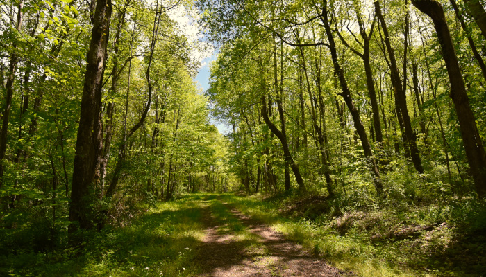
We’ve been on every trail in New River National Park, and while we love the most popular trails like Endless Wall and Long Point, we find ourselves drawn to the quiet beauty of the lesser-hiked trails. We’ve included a link in each trail description for directions to the trailhead so you can check them out for yourself.
Glade Creek Trail
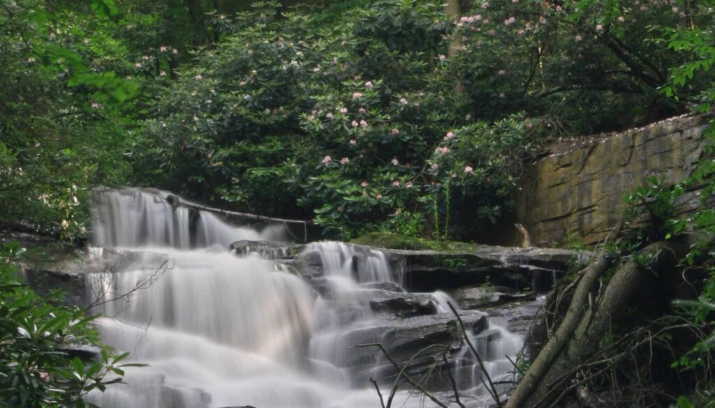
“Absolutely gorgeous” is what most of our guests say when we take them to this trail. Glade Creek Trail is a long trail (5.6 miles one way, 11.2 miles total), so sometimes we only hike half, but the trail is wide and gently slopped and perfect for an all-day adventure. Glade Creek has a beautiful waterfall and the best swimming hole in the New River Gorge. Near the southern trailhead, there’s a short access trail to Kate’s Falls which is a real stunner!
Polls Plateau Trail
This is a very remote trail and that’s exactly why we love it! Polls Plateau Trail goes through an upland forest, passing through an old farmstead along the way. This 4.9-mile loop trail is great for wildlife viewing. Make sure to study and download your map of this area. We once got lost – extending our hike by almost 2 hours – because one of the signs was missing at a confusing intersection with another trail.
Gwinn Ridge Trail
A beautiful 3-mile loop trail around a ridge line, the Gwinn Ridge Trail features the biodiversity of an older forest, interspersed with former pasture lands in transition. You’ll love this secluded and quiet trail near Sandstone Falls. You can also call the nearby Three Rivers Avian Center to see if they can provide a tour of their facility for rescued birds (304-466-4683).
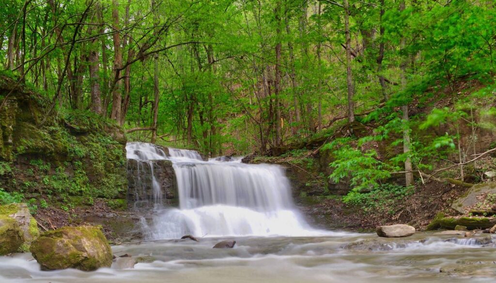
Big Branch Trail
Also in the southern section of the New River Gorge, near Sandstone Falls, you’ll find Big Branch Trail. This short (2-mile loop) trail is strenuous and timing your hike can be tricky. The trail is difficult to hike when the ground is wet, but the waterfalls won’t be flowing if it’s too dry. But if you hit it just right, the payoff is outstanding! We love traveling through this cove forest, enjoying the numerous waterfalls, and exploring the ruins of an old farmstead.
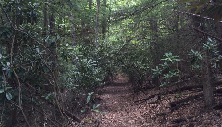
Butcher Branch Trail
Short but oh so sweet, Butcher Branch Trail passes through a tranquil pine forest. Shortly after entering the trail, there is a directional sign for a climber’s spur. This short but very steep spur leads to a beautiful waterfall and an active climbing area.

Park Loop Trail
The main reason we love Park Loop Trail is its proximity to Lafayette Flats Boutique Vacation Rentals. The trailhead is within Fayetteville Town Park which is only a 10-minute walk away. But the short 1.1 mile loop trail has other big perks. First, when it rains, this trail is FULL of a huge variety of mushrooms. Second, Park Loop Trail connects to the Fayetteville Trail which affords you access to almost the entire trail system in the northern section of the park. ***2025 UPDATE: A bike skills course is being constructed in the center of this loop trail. Construction does not interfere with hiking the trail, but it can be noisy.***
Rend Trail
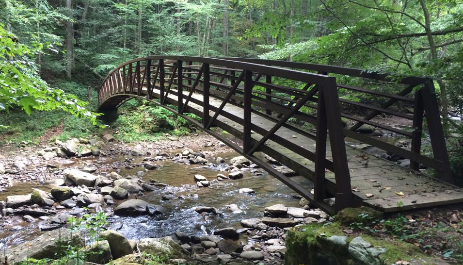
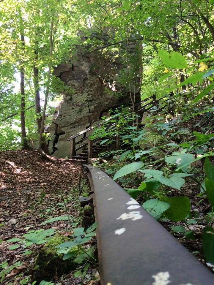
Rend Trail provides views of the historic town of Thurmond and the New River, and crosses several old train trestles. A house-size sandstone boulder that detached from the nearby cliff now blocks the old railroad bed, and steps have been permanently constructed to bypass the bolder. Special note: the trail is currently closed at 1.9 miles due to structural damage to a bridge, but we still recommend hiking the open section.
Stone Cliff Trail
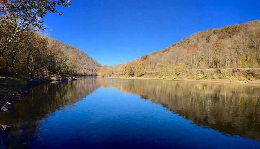
The Stone Cliff Trail has a lot to offer: it parallels the New River, leads to an old-growth forest, and has an impressive display of ferns and wildflowers. But it ranks as one of our favorite trails for a very specific reason – Mary Drapers Ingles almost certainly walked along this same route on her epic voyage home from captivity by the Shawnee Indians. Of course, this trail is only 3 miles long (6 miles out and back) and Mary Draper Ingles walked 500-600 miles, but we still love to imagine the route through her eyes and think about how the forest has changed since her 1755 trek.
Southside Trail
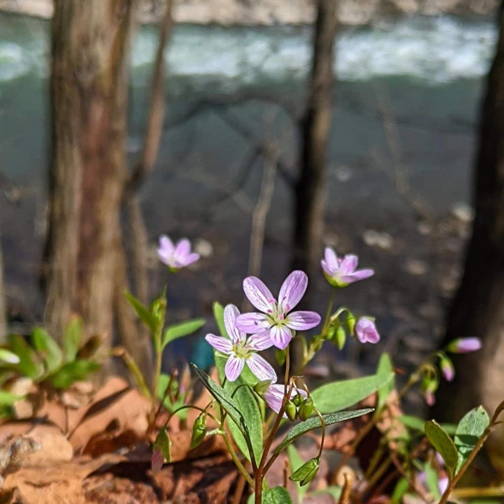
Southside Trail is an easy seven-mile riverside trail that provides great views of the New River and passes through several abandoned mining towns. It’s one of the few trails in the New River Gorge National Park that travels along the river, and numerous side trails lead to the river’s edge. We hike Southside Trail several times a year and it’s our favorite trail for wildflower viewing.
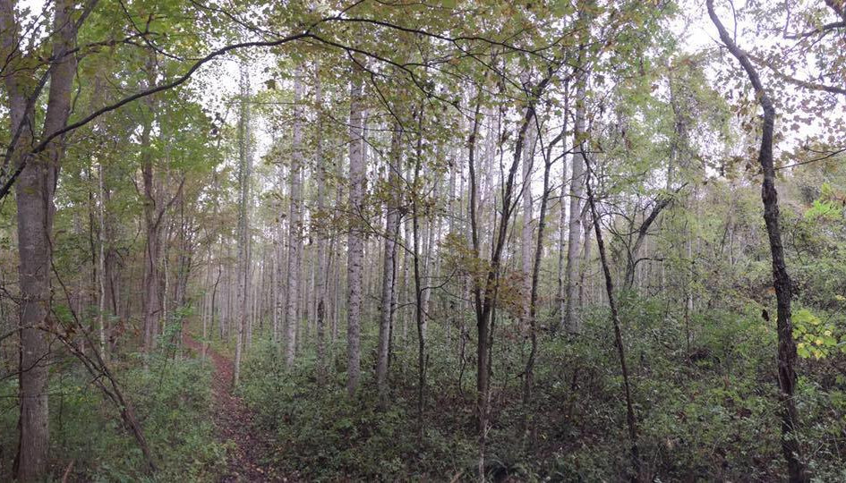
Terry Top Trail
We love this trail because it is VERY quiet, passes an impressive vernal pool (frog pond), and leads to a cemetery full of yucca plants (once used as grave markers due to their longevity and hardiness). The trail is 1.8 miles long (3.6 miles round trip). ***2025 UPDATE: Large scale strip mine restoration is occurring along this trail. We recommend only hiking to the frog pond. The scenery beyond is currently extremely bleak where hundreds of inappropriately planted pine trees have been removed to begin better restoration work. ***
Directions from Fayetteville to Terry Top trailhead: Take US-19 South toward Beckley for 10.8 miles. Exit left toward Glen Jean (you will see an Exxon/Subway on the left). Turn right immediately at the stop sign onto WV-6 S/WV-61 S. Travel for 2.7 miles and then turn left onto WV-61 South. Travel 1.9 miles and turn left at the large Summit Bechtel sign. Drive 1.1 miles along this road and take the first PAVED road on the right (Mill Creek Rd). The road soon turns to a gravel-surfaced one. Drive 1.6 miles, passing the National Park boundary sign on the left. The trailhead will be .4 miles inside the boundary on the right (look for a gate). It is marked by a 4’ pole sign (easy to miss).
Who are we? Amy & Shawn, New River Gorge hikers, master naturalists, and owners of Lafayette Flats Boutique Vacation Rentals in downtown Fayetteville, WV – the heart of New River Gorge National Park.
Craving more data for your New River Gorge exploration?
Where to Swim, Kayak and SUP in the New River Gorge


